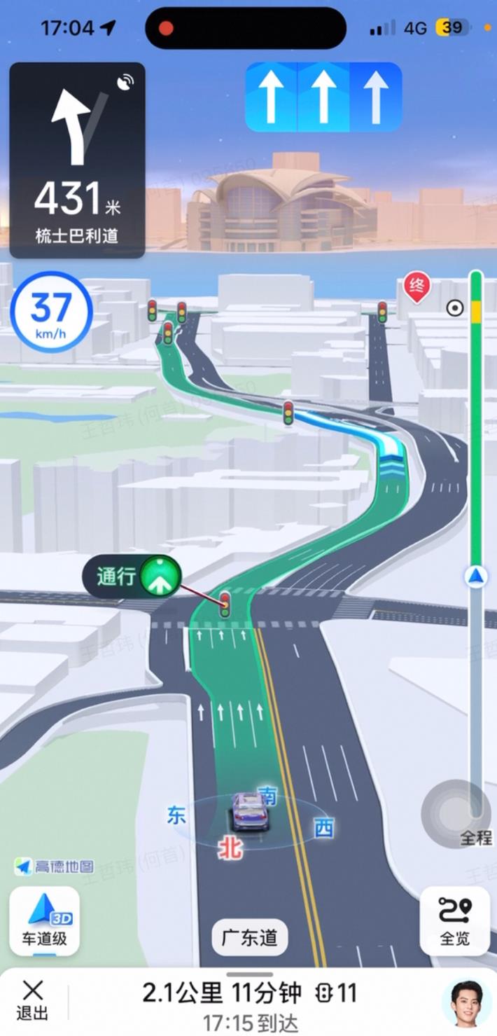
Autonavi announced the launch of "Guangdong-Hong Kong-Macao Integrated Navigation", which realizes the first unified navigation experience in the Greater Bay Area based on Beidou
Recently, on the 24th anniversary of Macau’s return to China, Autonavi Maps announced the official launch of "Guangdong-Hong Kong-Macao Integrated Navigation". This service is based on the research and development of the Beidou satellite navigation system, and is committed to providing accurate and convenient navigation and travel services in the Greater Bay Area. It realizes a seamless connection with the use experience of Autonavi maps in the mainland, so as to better serve the increasingly hot "south-up-north-down" two-way travel and promote economic integration and development. This is also the first map navigation product in the industry to span the Guangdong-Hong Kong-Macao region and achieve a unified experience.
According to reports, in order to achieve the goal of integrated travel and navigation in the Greater Bay Area, this Autonavi map is based on Beidou positioning technology and has launched a number of innovative functions for Hong Kong and Macao, including lane-level navigation, intelligent traffic light countdown, tunnel navigation, and intersection guidance maps, etc., which have greatly improved the level of route planning and navigation services in the Guangdong-Hong Kong-Macao Greater Bay Area.
For example, the Beidou lane-level navigation service, Autonavi’s self-developed deep learning model, can realize the 3D automatic modeling of the whole road network integration, and realize the fully automated 3D mapping of building roads, natural environment, urban landmarks and other elements in the map in Hong Kong and Macao; and based on the AI dynamic vision technology for driver human factors engineering, it can dynamically adjust the navigation screen closer to the driving perspective according to the current location and road shape, and build a digital world that combines virtual and real, allowing users to see what they get during the navigation process, "second understanding".
After the launch of "Guangdong-Hong Kong-Macao Integrated Navigation", Autonavi Beidou lane-level navigation has been further popularized nationwide and has become the largest lane-level navigation service in the world.

There is also an intelligent traffic light countdown service, which is also based on the continuous and stable positioning ability of the Beidou system, combined with cutting-edge technologies such as artificial intelligence and smart transportation to build core computing power, so that the real-world traffic light countdown countdown can be realized on the APP. "Mirror" reproduction.
According to reports, the Autonavi smart traffic light service was first launched in the mainland in May 2022. This is the first red light countdown service in the industry to be launched on the smartphone terminal and "anticipate" second-level changes in computing power. As of now, the daily countdown service provided by Autonavi smart traffic lights nationwide has exceeded 2 billion.

In addition, Autonavi tunnel navigation has also been launched in Hong Kong and Macao. Based on the self-developed "inertial navigation spatial positioning technology", it integrates mobile phone sensors, road networks, mobile networks, satellites and other elements for mixed real-time computing, which greatly alleviates the stability of positioning signals in tunnels.
Autonavi tunnel navigation was first launched in March this year and is the first domestic tunnel navigation technology solution with complete positioning capabilities and based on smartphones.

There is also the Autonavi cross-city bus service, which can also realize the integrated travel plan planning that spans any city and region in the Greater Bay Area, covers multiple travel modes such as bus, walking, cycling, and calculates extremely fine time and distance, truly achieving a "door-to-door without dead ends", one-click intercity public travel planning service.


In addition to the above features, Autonavi Maps has also added practical services such as intersection guidance large map, riding and walking navigation in the Greater Bay Area, and greatly updated and optimized the data "freshness" in the area (for example, the Hong Kong-Zhuhai-Macao Bridge that has just started trial operation has also been included in the route planning plan), dedicated to further strengthening the unity of navigation and travel services in the Greater Bay Area.
As a professional provider of digital map content, navigation and location-based service solutions, Autonavi Maps has always been committed to using technological innovation to transform various cutting-edge technologies into civilian transportation services to provide users with a better travel experience. In the future, Autonavi Maps will also continue to improve in the field of technology to better serve the transportation of the majority of users.